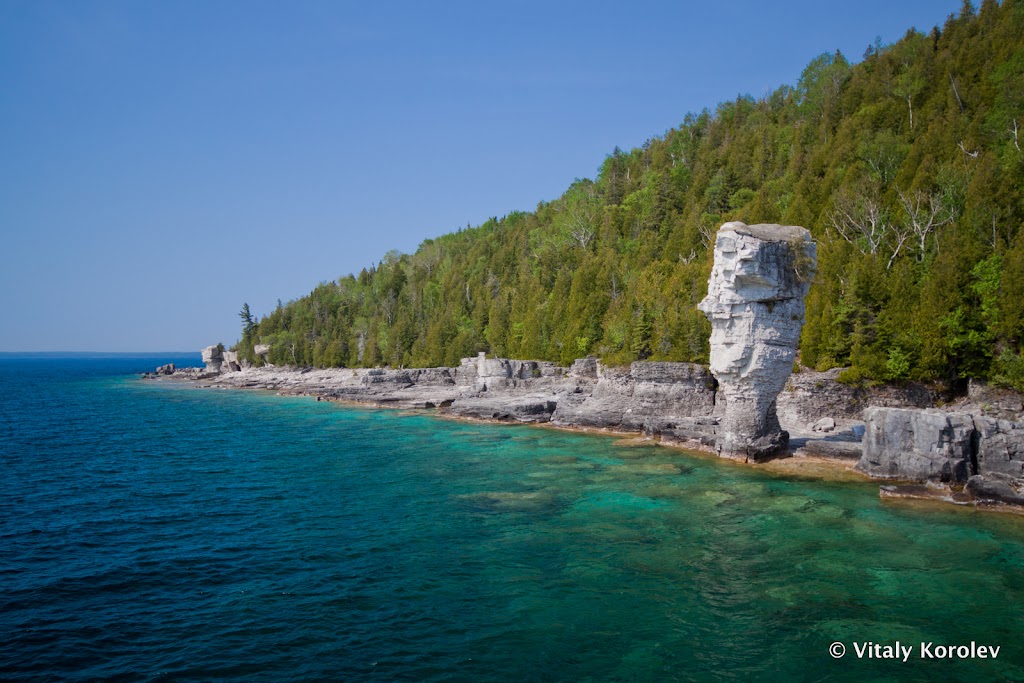
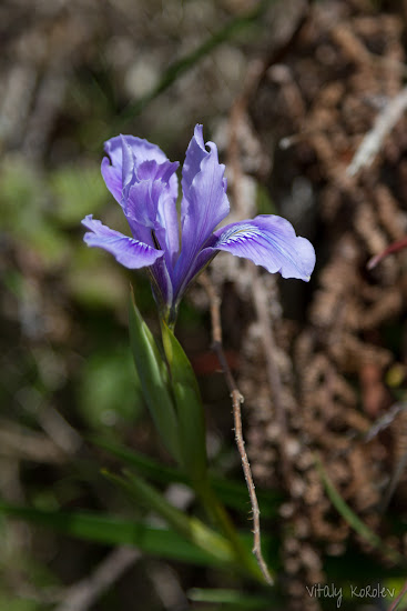
This is a photo from my favorite place in Ontario – Bruce Peninsula and the surrounding islands of Georgian Bay. This one in particular is at the Flowerpot island, famous for the curious rock formations. It was taken on a sunny day in May. Typical for a calm sunny day, the turquoise water looks very inviting (some people have compared it to the Caribbean!) However, even a short swim would be a very refreshing experience, with the water temperature in Georgian Bay rarely reaching 18 C (64 F).
Monthly Archives: April 2012
My favorite photos: Flowerpot Island
North Peak at McNee Ranch State Park
Date: April 15, 2011
McNee Ranch State Park
This time, we set out to explore McNee Ranch State Park. This park is located near the Pacific ocean, and has some nice trails going up into the rugged coastal hills. The plan for the day was to hike to the North Peak (elev. 1898 feet/579 meters). As a nice bonus, our dog Lily could come with us (no dog restrictions in the park, yay!)
North Peak Access Road
The trail we took was actually a fire road going up into the hills, commonly known as “North Peak Access Road”. The road was a bit washed out at times due to recent rains, but at least there was no deep mud. There were a few leg-burning steep sections along the way, but it was manageable (especially with our tendency to stop every 5 minutes for a photo of something pretty). This time, the reasons to stop consisted of fantastic views of the Pacific coast and lots of spring wildflowers. We were dazzled by at least a dozen of totally new varieties that we had never seen before (which was extra impressive given our recent hike to Mount Diablo, where we had seen lots of different flower varieties as well).
North Peak
We got a bit unlucky with the weather – the tops of the hills were completely covered with thick fog. We could see the trail and the vegetation around, but everything else was milky white. Great panoramic views were out of the question, but at least the fog gave our immediate surroundings a unique mysterious and almost magical character.
The North Peak turned out to be occupied by some human-made structures, which were making loud and annoying buzzing noises. The fog was still blocking all the views, so there was no reason to stay too long at the top. We made sure to find the highest point, and then started heading back. On the way back, the fog lifted somewhat, and we were able to see some views to the other side of the ridge.
Montara Beach
There was a very nice beach right across from the place where we had parked, and this is where we headed after we got back from the trail. It was a very enjoyable experience to soak the hot and tired feet in the cool refreshing Pacific waters. Going to the beach is now officially my favorite thing to do after a hike.
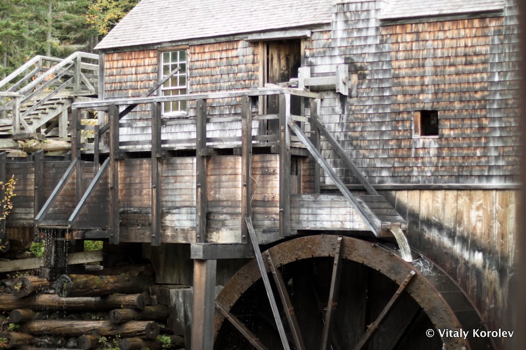
My favorite photos: Old Sawmill
We found this amazing old sawmill in Kings Landing historic settlement near Fredericton, New Brunswick.
Easter in San Francisco
Date: April 8, 2012
For the Easter Sunday, we decided to go to San Francisco, check out the party at the Dolores Park, and explore the surrounding Mission District.
Mission Dolores
The first stop was at Mission Dolores , famous for being the oldest surviving structure in San Francisco. We got there while the Easter Mass was still in progress in the Mission Basilica, and the museum at the Mission was closed for the Easter. We stayed outside to enjoy the architecture, and, of course, take some photos:
Dolores Park
The next stop was at the Dolores Park, which was supposed to have some Easter Festivities going on. When we arrived to the park, we realized that the party came with a twist. Apparently, the Easter celebration at Dolores Park is an annual event hosted by the San Francisco queer community, with all the associated over-the-top cool funky-costumed goodness (including the famous “Hunky Jesus” contest). It was very refreshing to see so much open-mindedness concentrated in one area, and it reminded me of Toronto quite a bit. It was definitely a nice and fuzzy “feels like home” moment.
We didn’t want to spend all the day in one place, so eventually we decided to leave the party behind and continue exploring the neighborhood. Just as we were leaving the park, we found what must be the coolest playground I had ever seen. It was really large and it had everything one would ever want on a playground: a pirate ship, a giant spider’s web, and a big slide. It was probably a good thing that there were so many people using it; otherwise, I would have been stuck there for several hours.
Mission District
Mission street is just a couple of blocks away from Dolores street, but they couldn’t be more different in character. Dolores street was very quiet and genteel; it was lined with neat Victorian houses, manicured lawns, and stately trees.
Mission street, in contrast, was anything but quiet. It was lined with small shops selling all sorts of trinkets, swarming with people of all walks of life, and brimming with Latin culture.
We spent the rest of the day enjoying the character of that lively neighborhood and the famous Mission District murals (which lined practically all the walls, and sometimes entire buildings).
Hiking Mount Diablo
Date: April 1, 2012
Elevation: 3,848 feet / 1,178 m
Via Summit trail, approx 12.5 miles/20km distance and 3100 feet/950 meters elevation difference
Mount Diablo
Mount Diablo is pretty cool for several reasons. The first and most obvious one is the intriguing name. The second one is that this mountain is quite prominent relative to its modest height. Practically, it means that there is nothing around to obstruct the views, so the vistas from Mt Diablo’s summit are really great. All of that, combined with the fact that it’s one of California’s Counties Highpoints meant that we simply had to go!
Summit Trail
The trail-head for the Summit Trail turned out to be outside of the park entrance. That made for a bit of an awkward parking situation on the edge of the road (it’s a good thing we like to start early – the “parking lot” was already almost full when we got there). It also meant not paying the park entrance fee (yay) and not getting the official park trail map. We had some topo maps on Vitaly’s iPad, so the theory was that we would be just fine without a park map (sinister pause…)
California mud
The day before, it was raining cats and dogs. After all the mud we’d been through on the Bruce Trail, it seemed unlikely that an isolated California shower would pose much of a threat. However, as soon as we started hiking, we discovered that California mud was not the same as Ontario mud. The California variety of mud was really really sticky. The feet kept getting stuck to the ground, and quickly got covered in thick and heavy layer of dirt. This is how our shoes looked like about 5 minutes into the hike:
It looked like we were the only people
Wrong turns at Rock City
Eventually we reached the area of the park called “Rock City”, named for large boulders scattered throughout. Here, the trail passed through a large campground with lots of paths going off in all directions. The trail signage was extremely confusing, so we decided to use one of those topo maps from the iPad to guide us. The map sent us walking on the paved road for quite a while, until eventually we reached a rough track marked as “Summit Trail” going off into the woods. Happy to be off the road, we followed the trail and soon reached … the same campground we had passed by half an hour before. Apparently, the topo map was out of date. The trail didn’t actually follow the road. It went along a different route – we ended up walking this section in the wrong direction from the point the trail intersected with the road. This little “detour” added about 2km to our hike, and about 100m of extra elevation difference.
Spring flowers and huge cones
Grumbling at the evil mountain spirits who must have been playing April’s fools jokes on us and leading us in circles, we continued our trip (this time in the right direction). Soon we got out of the boulder field of Rock City, and into the wide open meadows. This is where we got to appreciate the dazzling spring flowers blooming all around. There were many different varieties (at least 10 that I counted) of all colors of the rainbow (except green). The most obvious ones were the bright orange poppies.
My favorites though were these tiny flowers that I don’t know the name of. They were growing right on the edge of the trail; it was an extra challenge to avoid trampling them.
There were some trees along the trail as well, mostly some variety of pine. These trees (of species Coulter Pine
 , according to wikipedia) had enormous cones. The biggest one we found was bigger than my head! These giant (and very heavy) cones also had very sharp spiny edges, making it a real hazard to hang around under these trees.
The Summit
About 1.5 miles short of the summit, I started to get a pretty nasty cramp in the leg. I really didn’t want to give up this close to the goal, so we continued on. Eventually, we got to the top. It felt very satisfying. Unfortunately, the feeling of serenity and solitude usually found on mountain tops was missing – Mount Diablo has an auto road going to the top, so the summit is always teeming with crowds of people who drive there. We stuck around just long enough to take a mandatory summit photo and visit the gift shop (we bought the map, but forgot to get the “I climbed Mount {X}” badge to add to my collection :(). In the hurry to get away from the crowds and back to the trail, we almost missed the actual summit, which was (!) enclosed inside the gift shop structure.
Getting back
I was lucky – the leg cramp went away after some stretching. We got back without any extra adventures, taking some more photos along the way. As always, I was amazed at the surprising and counter-intuitive difficulty of getting down a mountain.
Somehow, the views seemed much better going down (could this be related to not having a cramp in the leg?) It’s on the way down when I finally decided that, despite the parking lot at the top, Mount Diablo is one great hike.
“W” Tree Rock Scramble
Date: Mar 18, 2012
We have been trying to check out Sunol Regional Wilderness for a while. Somehow, things kept getting in the way (bad weather, couch potato-ness, and even leaving the wallet at home and driving all the way to the park to find out that we can’t pay the entrance fee). Finally everything lined up, and we set out to visit the park, especially the intriguing “Little Yosemite” section that stood out on the park map.
Little Yosemite
The hike to the “Little Yosemite” area was an easy and short one – it followed a park dirt road. However, we took our sweet time, enjoying the colorful spring flowers sprouting from everywhere (even from rocks)
Little Yosemite turned out to be a little gorge carved out in the surrounding hills by Alameda Creek. I wouldn’t try to compare it with the Yosemite proper (the bar is just way too high). However, on a more reasonable playing field of nearby local parks, it measured up to be a pretty cool place after all. The water level in the creek was pretty low, so there were a lot of cool colorful rocks exposed. One of them appeared so out-of-place that we quickly nicknamed it “Alien Blue Rock”
W Tree …
As always, I was staring at the park map during one of the numerous photo-stops (mmm… maps… drool…). This time, the staring turned out quite productive. I spotted a little creek with an intriguing name “W Tree”. It was fairly close to our planned route, so we just couldn’t resist making a detour to satisfy our curiosity about the puzzling name. When our path crossed the creek, it became apparent what was meant by the “W Tree”:
… Rock Scramble
It also became apparent that I had missed the second half of the creek name, the full version being “W Tree Rock Scramble”. There was a rough side trail going in the direction of the W tree, and there was simply no way we could resist the temptation of exploring further. The trail quickly reached the creek bed and disappeared, but that only served to stoke our adventurous spirit. We continued up the creek, hopping over the stream numerous times and scrambling through the giant rocks which were scattered all around.
The new plan was to keep travelling up the stream until we reach an intersection with an official trail, which we would use to go back to the parking lot. So, the rock hopping activity went on. For the first half an hour, it was really fun and exciting. After that, it started to become a little repetitive. After an hour of jumping through the rocks and wading through the cold creek water, our little dog Lily got cold, tired, and miserable (Vitaly & me may or may not have gotten tired, but that is not to be discussed… Yeah, blame it all on Lily.) Rough estimates of our position placed us more than half-way to the next trail (just the luck – a rare reason to use those wilderness nav skills comes along, and I don’t have my compass with me!) We decided to continue upstream and try to find a way to higher and more level ground. It took a couple of attempts, but we finally got out. Lily was happy to be back on the open grassy hillsides with no rocks or cold water (and plenty of cow patties to sniff). Vitaly & me were also enjoying off-trail hiking, with all that fresh green spring grass and total solitude.
Soon we reached the trail which would take us back. From that point on, it was easy going, mostly downhill all the way – in all the excitement of the creek scramble we didn’t realize that we were gaining quite a bit of altitude. Along the way, there were some nice views from the higher ground – a nice ending to an exciting and fun day.


